
Description
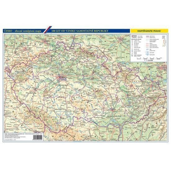
For the centenary of the establishment of the Czechoslovak Republic, we have prepared an original pocket map. The front side features 12 maps depicting the gradual development of state formations in our territory, from the era of Great Moravia, through the Czech state under the Přemyslids and Luxembourgs, the Habsburg monarchy, the First Republic, to present-day Czechia. The maps are additionally supplemented with a clear timeline listing all monarchs and presidents. The reverse side of the map shows contemporary Czechia with all significant rivers, mountain ranges, lowlands, and peaks, as well as the basic network of roads and railways, regional borders, and large and small towns and villages. The practical format offers wide usage - from a desk pad, hanging on a family or work bulletin board, to a practical school aid. • double-sided laminated map • development of the Czech lands in maps from the 9th century to the present • overview of all monarchs and heads of state on a timeline • clear general geographical map of Czechia
Information
Language: Czech
Publication date: May 8, 2018
Manufacturer: KARTOGRAFIE Praha, a. s.
Genres: Non-fiction literature, Maps and guides, Books, Travel
Type: Maps & atlases
ISBN/EAN: 8594033222222