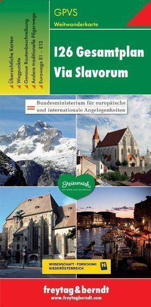

Beschreibung
Dank detaillierter digitaler Kartografie und präziser Maßstäbe sind die Wanderkarten von Freytag & Berndt ideale Begleiter für Wander-, Berg- und Skitouren. Sie werden regelmäßig aktualisiert und enthalten stets aktuelle Informationen zu Wanderwegen, Rad- und Bergpfaden, Hütten, Naturdenkmälern, Kulturstätten und Freizeiteinrichtungen. Die beigefügte Informationsbroschüre enthält präzise Beschreibungen des Fernwanderwegs „Via Slavorum“ (I26), kategorisiert nach Ländern. Weiterführende Informationen sind auch zu anderen internationalen Fernwanderwegen in Österreich, den Eurotrails E1 bis E12 und weiteren traditionellen Pilgerwegen nach Rom verfügbar. (Sprache: Deutsch) Übersichtskarte, Wegpunkte, präzise Routenbeschreibung, weitere traditionelle Pilgerwege, Eurotrails E1 – E12; Gebiet: I26 Via Slavorum, Polen, Tschechien, Österreich, Slowenien, Italien; Weitere Fernstraßen: E1 – E12, internationale Fernstraßen durch Österreich wie I21, I23 und I25, Pilgerwege nach Rom wie Via Romagna, Frankenweg, Via Romea.
Information
Language: Czech, German, English, Italian, Slovenian
Publication date: 1. Januar 2012
Manufacturer: FREYTAG-BERNDT, spol. s ro
Genres: Karten und Reiseführer, Touristenkarten der Tschechischen Republik, Karten von Italien, Städte Europas, Karten der Tschechischen Republik, Bücher, Reisen, Touristenkarten, U-Bahn, Nach Stadt
Type: Karten und Atlanten
ISBN/EAN: 9783707914092