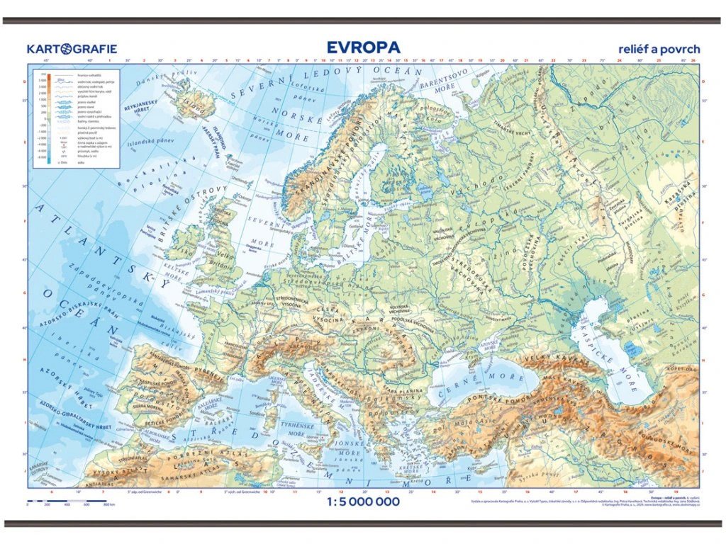

Beschreibung
Eine übersichtliche Karte der europäischen Orographie und Hydrologie zeigt alle wichtigen geographischen Merkmale von Land, Meer und Ozean inklusive ihrer Bezeichnungen. Zur besseren Orientierung sind Staatsgrenzen und ausgewählte Großstädte eingezeichnet. Die Höhenangaben, dargestellt durch farbige Hypsometrie, werden durch Schattierungen ergänzt, die die Reliefwahrnehmung verstärken. Die Karte wurde im Sommer 2024 aktualisiert.
Aus dem Inhalt:
Europa 1: 5.000.000 im physisch-geographischen Format
Alle wichtigen Gebirgszüge, Gipfel, Ebenen, Flüsse, Seen, Inseln und Halbinseln
Meere, Buchten, Meerengen, Meeresbodenformen
Schattiges Gelände
Laminierte Karte mit Holzleisten oben und unten
Ein Verzeichnis der Wand- und Taschenkarten, die auf dem Portal ŠkolníMapy.cz zum Download verfügbar sind.
Information
Language: Czech
Publication date: 30. Juni 2025
Manufacturer: KARTOGRAFIE Praha, as
Genres: Schulatlanten und Karten, Bücher, Lehrbücher und Sprachen
Type: Karten und Atlanten
ISBN/EAN: 8594033222895