
Beschreibung
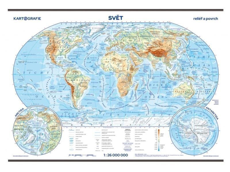
Die Wandkarte in Robinsons Projektion veranschaulicht und beschreibt die wichtigsten geographischen Formen der Kontinente und Ozeane der Welt. Die Hauptkarte wird durch Ausschnitte der nördlichen und südlichen Polarregionen ergänzt. Neuauflage in überarbeitetem Design. Zu jeder Wandkarte erhalten Schülerinnen und Schüler kostenlos 20 Taschenkarten für ihren Schreibtisch. Das separate Blatt zeigt auf der Vorderseite eine verkleinerte physische Weltkarte im Maßstab 1:85.000.000 und auf der Rückseite eine Umrisskarte (leer). Die Weltkarte im Maßstab 1:26.000.000 ist physisch-geographisch gestaltet. Schattiertes Gelände. Ausschnitte der Polarregionen. Laminierte Karte mit Holzleisten oben und unten. 20 Taschenkarten für den Schreibtisch mit einer Umrisskarte auf der Rückseite. Ein Index für Wand- und Taschenkarten steht unter www.skolnimapy.cz zum Download bereit.
Information
Language: Czech
Publication date: 1. Oktober 2023
Manufacturer: KARTOGRAFIE Praha, as
Genres: Schulatlanten und Karten, Bücher, Lehrbücher und Sprachen
Type: Karten und Atlanten
ISBN/EAN: 8594033222581