
Beschreibung
Die laminierte Taschenkarte im A3-Format basiert auf der Schulwandkarte und stellt die Geschichte und Gegenwart der europäischen Integration dar.
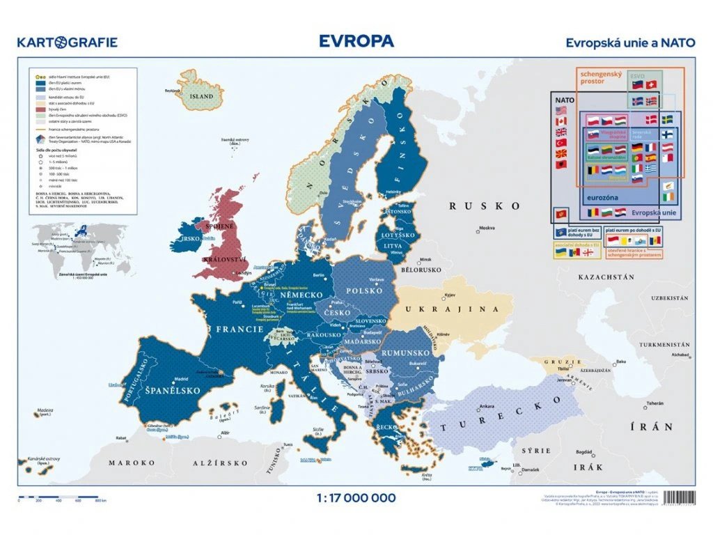
Die Karte ist ein ideales Hilfsmittel für alle, die sich im Vorfeld der tschechischen EU-Ratspräsidentschaft über die aktuellen Ereignisse informieren möchten.
Auf der Vorderseite befindet sich die Hauptkarte im Maßstab 1:17.000.000, die die Mitglieder der Europäischen Union, der NATO und der Europäischen Freihandelsassoziation zeigt. Die Karte enthält außerdem Beitrittskandidaten, Länder mit Assoziierungsabkommen mit der EU, Schengen-Staaten, Euroländer und die wichtigsten EU-Institutionen.
Zusätzlich zeigt eine Seitenkarte die Überseegebiete der EU und ein Diagramm zum aktuellen Stand der europäischen Integration.
Auf der Rückseite finden Sie eine Karte, die die historische Entwicklung der EU zeigt, eine Zeitleiste mit Meilensteinen der europäischen Integration und eine Infografik, die die Position der Tschechischen Republik in der EU in Bezug auf Geographie, Demografie und Wirtschaft darstellt.
Darüber hinaus enthält die Rückseite Beschreibungen der wichtigsten EU-Institutionen, EU-Symbole und Informationen über alle Mitgliedstaaten, einschließlich ihrer Flaggen.
Information
Language: Czech
Publication date: 30. Juni 2025
Manufacturer: KARTOGRAFIE Praha, as
Genres: Karten und Reiseführer, Bücher, Reisen, Sachliteratur
Type: Karten und Atlanten
ISBN/EAN: 8594033222529