
Beschreibung
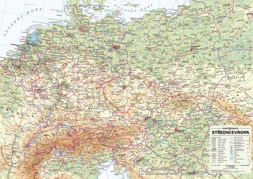
Eine übersichtliche Karte Mitteleuropas, die die wichtigsten Elemente politischer und physischer Karten vereint: Ländergrenzen und -namen, alle wichtigen Städte, Topografie und Hydrologie mit Darstellung markanter geographischer Merkmale inklusive ihrer Namen. Die Höhenangaben, dargestellt durch Farbskalen, werden durch Schattierungen ergänzt, die eine bessere Wahrnehmung des Reliefs ermöglichen. * Mitteleuropa 1:1.715.000 im allgemeinen geografischen Maßstab * Länder Mitteleuropas und ihre Hauptstädte * Beschreibung der Bundesstaaten und historischen Einheiten * Gewässer, Gebirgszüge und höchste Gipfel, Tiefebenen, Inseln und Schären * Schattiertes Gelände * Laminierte Karte mit weißen Kunststoffstreifen, in einer Röhre verpackt.
Information
Language: Czech
Publication date: 20. Mai 2021
Manufacturer: KARTOGRAFIE Praha, as
Genres: Sachliteratur, Karten und Reiseführer, Rubbel- und Wandkarten, U-Bahn, Bücher, Reisen
Type: Karten und Atlanten
ISBN/EAN: 8594033222475