
Description
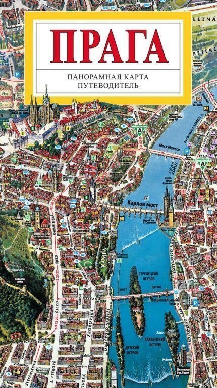
The panoramic map of the wider center of Prague expands the scope of the previous map of the historical center to include additional districts that emerged on the sites of historical suburbs - in the north, it depicts a larger part of Dejvice, the meander of the Vltava River with Holešovice and Troja, parts of Libeň and Vysočany. In the east, it primarily includes districts that developed during the 19th century - Karlín, Žižkov, Vinohrady, Vršovice, Nusle. In the south, the map is framed by part of the Pankrácká plain with contemporary modern buildings, and on the right bank of the Vltava, the southern part of New Town with Vyšehrad. Between the left bank and the western edge of the map is a larger part of Smíchov and districts such as Radlice, Košíře, Břevnov, and Střešovice. The illustrated guide contains drawings and descriptions of 132 heritage sites depicted in the map and a reference plan of the Prague metro.
Information
Author: Rygl Tomáš
Publication date: October 1, 2012
Manufacturer: ATP Jihlava
Genres: Maps of prague, Non-fiction literature, Books, Travel, Maps and guides, By city, Cities of the czech republic
Type: Maps & atlases
ISBN/EAN: 9788086893808