
Description
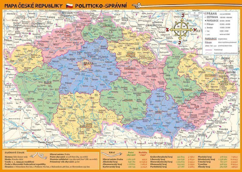
The A4 laminated card is suitable as a tool for elementary and secondary school students in geography subjects. On one side is a geographical map of the Czech Republic highlighting mountain ranges and waterways, while the other side features an administrative map showing the borders of regions, major road connections, and cities differentiated by population size. The map is supplemented with basic information about our republic, such as area, population, neighboring countries, etc.
Information
Language: Czech
Publication date: October 4, 2017
Manufacturer: Euromedia Group, a.s.
Genres: Books, Textbooks and languages, Textbook for primary school grades 1-5, Children's literature, Social studies for primary school, Popular science literature for children
Type: Laminated tables
Pages: 2
ISBN/EAN: 9788075494993