
Description
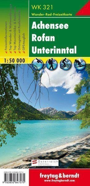
The tourist map 321 Achensee - Rofan - Unterinntal, 1:50,000 is regularly revised and contains up-to-date information on hiking trails, cycling and mountain biking routes, huts, natural monuments, cultural sites, and leisure facilities. The accompanying information brochure includes a selection of the best hiking trails, bike paths, and mountain bike routes, as well as a brief description of huts and mountain inns. (Language: German) Details: Information for leisure activities, hiking and long-distance hiking trails, mountain biking and cycling routes, index of places with postal codes, GPS compatible, via ferrata, ski route, cross-country skiing route, Nordic walking route: Region: Achensee, Unterinntal, Rofangebirge, North Tyrol, Tyrol, Austria, Tegernseer Berge, Bavaria, Germany; Special thematic hiking trails: Northern Alpine Trail, Jakobsweg, Adlerweg, Via Alpina, Around Vomper Berg, Ebner Joch, Rofanspitze, walking to Lake Berglsteiner See; Special cycling and mountain biking tours: Tirol Cycle Path, Inn Cycle Path, Alpbachtal Tour, Panoramic Path; Regional maps: WK 121, WK 151, WK 152, WK 241, WK 301, WK 322. Thanks to detailed digital cartography and precise scales, ...
Information
Language: German, English, French
Publication date: January 1, 2019
Manufacturer: FREYTAG-BERNDT, spol. s r.o.
Genres: Underground, By city, Books, Travel, Maps and guides
Type: Maps & atlases
Pages: 4
ISBN/EAN: 9783850847575