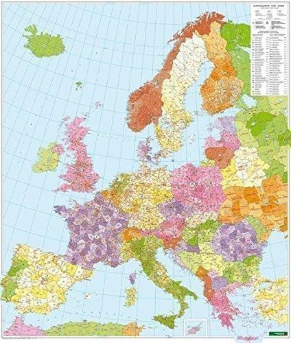

Description
Freytag & Berndt "Map of Postal Codes in Europe" 1:3.7 million is supplied as a rolled map in a plastic tube. Glossy carbon steel strips are attached to the top and bottom to ensure that the map hangs straight and smooth on the wall. Format: approx. 96 x 112 cm; with hanging device. Freytag & Berndt postal code maps are also available in the following versions: folded, poster (flat in roll), marking board, and magnetic marking board.
Information
Language: German
Publication date: January 1, 2017
Manufacturer: FREYTAG-BERNDT, spol. s r.o.
Genres: Scratch-off and wall maps, Books, Travel, Maps and guides
Type: Maps & atlases
ISBN/EAN: 9783850844161