
Description
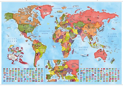
Do you want your little schooler or preschooler to have the countries of the world always in sight and to get to know the world in a natural way? Then you won't find a better decoration for a children's room than our illustrated map of the countries of the world for little travelers. As you already know from our illustrated atlas, eight-year-old twins Anička and Kryštof decided one day to prepare a world atlas for little travelers like themselves. They set off on a long journey, during which they visited all the continents and shared their experiences and knowledge with their peers through captivating illustrations, a travel diary, and other notes. But that wasn't the end. Upon their return, they took a political map of the world, which shows all the countries, redrew it into a wall map format, and marked all the landmarks, cities, means of transport, and populations they encountered. This resulted in a beautifully clear and readable political map of the world, which not only shows children the layout of the countries but also highlights the interesting features they can find in various areas. If you want to glean as much information as possible from the map, open the illustrated atlas alongside it, and you will learn what each picture represents. Everything is written and illustrated from the children's perspective, clearly and engagingly.
Information
Language: Czech
Publication date: July 1, 2023
Manufacturer: KARTOGRAFIE Praha, a. s.
Genres: Maps and guides, School atlases and maps, Books, Travel, Textbooks and languages
Type: Maps & atlases
ISBN/EAN: 8594033222673