
Description
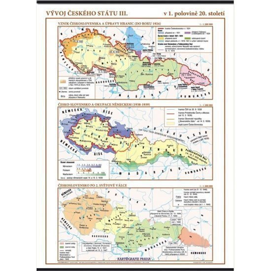
The wall map with three thematic maps illustrates the development of Czechoslovakia from the dissolution of Austria-Hungary to 1948. The maps clearly show territorial gains and losses during and after both world wars, as well as the post-war arrangement of the then state, border adjustments, and the main directions of foreign troops' advances during the occupation of Czechoslovakia in 1939. • The establishment of Czechoslovakia and border adjustments (up to 1924) • Czechoslovakia and the German occupation (1938-1939) • Czechoslovakia after World War II
Information
Language: Czech
Publication date: January 1, 2006
Manufacturer: KARTOGRAFIE Praha, a. s.
Genres: School atlases and maps, Books, Textbooks and languages
Type: Maps & atlases
ISBN/EAN: 8594033221096